It may seem like déjà vu, and it’s still not even officially
winter yet, but for the second time in just nine days, accumulating snow has
made a visit to the Mid-South! With another upper level disturbance moving
across the region overnight through Wednesday morning, precipitation which
broke out Tuesday evening across central Arkansas began to move into the metro
area. As colder temperatures and stronger upper-level dynamics moved in, light rain quickly changed to snow and the result was another decent accumulation
event for much of the metro. For some areas, snow amounts were heavier than
seen in the November 28-29 event, even though the event did not get nearly the hype prior to onset.
While it may have been a surprise to some, computer models came into agreement on the likelihood for snow accumulation in the area on Tuesday morning. Given the higher confidence presented by the model solutions, MemphisWeather.Net ramped up our snow forecast accordingly during the day and pretty much nailed the event by Tuesday evening. In fact, in this blog post, we provided a window of 1-3am for snow onset and 10am for an end time. Memphis Int'l Airport officially switched over to snow at 2:11am and the snow ended at 10:18am! We also predicted about an inch on grassy and elevated surfaces last night. While some locations in the northern metro got about 3" of snow, the official observation from Memphis was 1.3" with many metro locations reporting 1.5-2.0".
While it may have been a surprise to some, computer models came into agreement on the likelihood for snow accumulation in the area on Tuesday morning. Given the higher confidence presented by the model solutions, MemphisWeather.Net ramped up our snow forecast accordingly during the day and pretty much nailed the event by Tuesday evening. In fact, in this blog post, we provided a window of 1-3am for snow onset and 10am for an end time. Memphis Int'l Airport officially switched over to snow at 2:11am and the snow ended at 10:18am! We also predicted about an inch on grassy and elevated surfaces last night. While some locations in the northern metro got about 3" of snow, the official observation from Memphis was 1.3" with many metro locations reporting 1.5-2.0".
Similar to the November 28-29 event, temperatures throughout
the duration of snowfall were borderline, with readings near the freezing mark.
This meant that snow accumulation once again mainly occurred on grassy
surfaces and elevated or non-paved surfaces. However, where heavier snow fell
and temperatures briefly dipped to 31-32, some slush did accumulate on roadways in outlying areas and on a few bridges and overpasses
area wide. Fortunately, travel impacts still remained limited overall.
In the city of Memphis, snow amounts were more significant
compared to last week’s event, with several locations recording 1 to 2 inches
of total accumulation. Memphis International Airport received 1.3”, with 1.8”
at the National Weather Service in East Memphis. Other locations in Shelby
County received similar amounts, and these amounts were also common in the
other metro counties. Higher snow totals were found across portions of Tipton
and Fayette County, another similarity to last week, with some localized areas
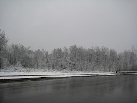
reporting unofficial accumulation of 3 to even 4 inches! Some pics we took this morning are below.
 |
| Snow on the weather equipment in the backyard at MWN. 1.5" total. |
 |
| North Bartlett about 8:15am. |
 |
| Austin Peay (Highway 14) at Old Brownsville - 8:15am. |
 |
| Back edge of clouds entering the Memphis metro. Taken at I-240 west of Airways. |
--Kevin Terry & Erik Proseus, MemphisWeather.Net
For weather information for Memphis and the Mid-South, where and when you need it, visit MemphisWeather.net on the web, m.memphisweather.net on your mobile phone, download our iPhone or Android apps, or visit us on Facebook or Twitter.

No comments:
Post a Comment