The Storm Prediction Center is giving ample notice to the southern plains and mid/lower Mississippi Valley that a storm system that will move across the region next week will have the main ingredients in place to produce severe weather. There are several issues that must still be resolved, including exact timing of the front, that must be worked out. However, very warm air (75-80 degree temps locally for several days) and plenty of moisture from the Gulf courtesy of 4-5 days of south winds, plus the front and strong wind at all levels of the atmosphere, are the main ingredients necessary to produce what may become a widespread multi-day severe weather event. The graphic below highlights the areas that SPC believes are at the greatest threat for severe weather Tuesday and Wednesday. These are subject to change in the coming days, but likely more in the fine-scale details than in whether or not severe weather occurs.
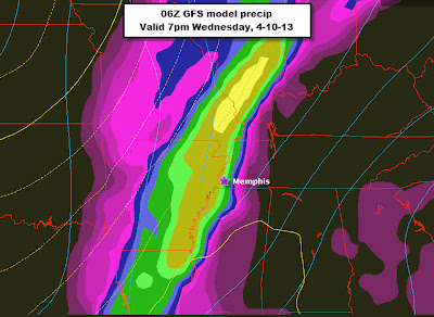
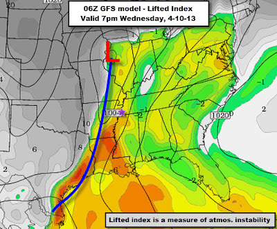
For the Mid-South, MWN is targeting Wednesday night as our most likely time for storms, some of which could easily be severe. The two main long-range models we use (GFS and European) are still several hours apart in their timing, but both indicate that severe weather is a good possibility. (Remember that model output is NOT a forecast, but one possibility of how a very complex situation might turn out.) With strong wind from the ground up to the jet stream, and sufficient "turning" of those winds in the lowest several thousand feet, the main concerns we have at this early date are damaging straight line winds (primarily) and tornadoes (secondarily). Hail is also a possibility, while widespread flooding does not at this time look too likely.
 |
| Latest European model output showing leading edge of an area of storms near the MS River overnight Wednesday night. |
 |
| Overnight model output from the GFS showing storms into the metro by early evening Wednesday, about 6-9 hours faster than the European model above. |
severe thunderstorm and tornado safety tips and be prepared for the spring severe weather season that some doubted would EVER come after the 2nd coolest March in the past 40 years!
Included in your severe weather safety plan should be multiple ways of getting severe weather warnings, including overnight. Do NOT count on sirens to warn you, especially if you are inside or asleep! (Why? Click here.) We highly recommend a smartphone app solution that will pinpoint warnings to the locations you select, as well as NOAA Weather Radio with battery backup. If you need a suggestion for a truly "smart" phone app, may we recommend our MemphisWeather.net app (mobile link) with StormWatch+ for Android and iPhone. It will wake you up if a dangerous storm is heading for your location, but not if it's headed for another part of your county.
--Erik Proseus, MWN Meteorologist
----
Follow MWN on Facebook, Twitter, and Google+
Visit MemphisWeather.net on the web or m.memphisweather.net on your mobile phone.
Download our iPhone or Android apps, featuring a fresh new interface and StormWatch+ severe weather alerts!


No comments:
Post a Comment