Synopsis
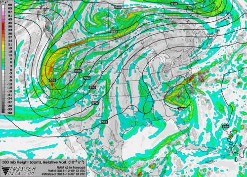
After an absolutely gorgeous Monday I'm pleased to inform you fall will continue across the Mid-South for at least the next few days. The drier air streaming in from the north is most welcome and I find that to be a bigger relief than the cooler temperatures themselves. Not too much to talk about weather-wise this week, but we do have a little upper-level disturbance that could bring some clouds Wednesday. Lets take a look.Analysis
 |
| NAM 500 mb (10,000') relative vorticity and heights at 12Z (7AM) Wednesday. |
| NAM 850 mb (5,000') relative humidity and wind vectors at 12Z (7AM) Wednesday. |
[EP: This minor "fly in the ointment" will be transient and have little effect on the forecast beyond Wednesday. We'll be back to partly cloudy skies on Thursday as some left-over moisture produces some clouds, with highs back near or slightly above normal.]
William's Memphis Forecast
TuesdaySunny with a high of 75, low of 60.
Wednesday
Overcast with possible peaks of sun in the afternoon, high of 75, low of 60.
Thursday
Partly cloudy with a high of 83, low of 62.
--William Churchill, MWN Social Media Intern
----
Follow MWN on Facebook, Twitter, and Google+
Visit MemphisWeather.net on the web or m.memphisweather.net on your mobile phone.
Download our iPhone or Android apps, featuring a fresh new interface and StormWatch+ severe weather alerts!

No comments:
Post a Comment