We started the week with beautiful spring weather and that looks to continue for the next few days. Highs in the mid 70's with lows in the lower 60's can be expected tomorrow and Wednesday. However, springtime also can mean the potential for strong thunderstorms and we'll see that possibility later this week.
By Wednesday afternoon there is a chance of showers and thunderstorms, which become more likely later that night as an upper level disturbance moves through. All activity is associated with a deepening surface low to the west and eventual cold frontal passage this weekend.
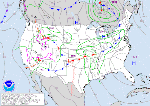 |
| The Weather Prediction Center's 48 hour forecast valid Wednesday morning (7 AM) |
Showers and thunderstorms on Wednesday should remain below severe limits. The time frame for greatest concern is
Thursday night when the best dynamics for severe weather are in the Mid-South.
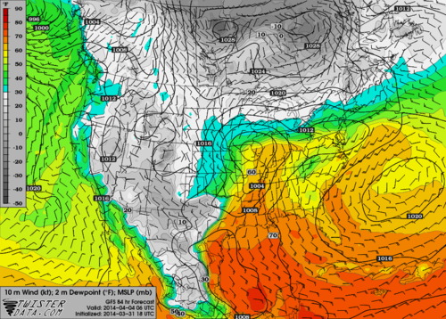 |
| GFS near surface winds and surface dew points valid 1am Friday |
Perhaps the most important ingredient for severe storms is low level moisture. Surface dew points in the mid 60's Thursday night are plenty high to fuel thunderstorms. Another thing to note are the near surface winds out of the south, an important ingredient for tornado potential.
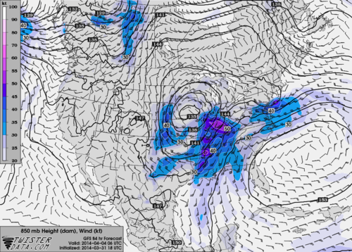 |
| GFS 5000' winds valid 1am Friday |
Winds near 5000 feet could be as high as 40 to 50 knots. These winds can be brought down to the surface in thunderstorms. An increase in wind speed and direction with height is also a vital component for potential tornadoes.
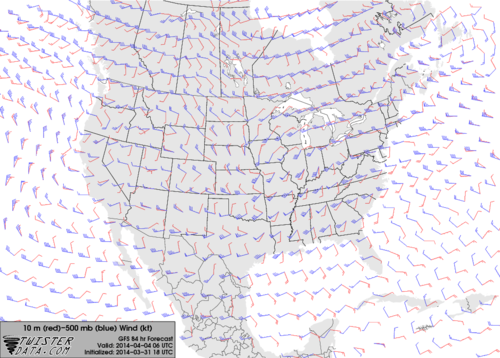 |
| GFS crossover winds from near surface (red) and 18,000' (blue) valid 1am Friday |
This map shows wind speed and direction at the surface (red) compared to 18,000 feet (blue). Memphis has about a 90 degree shift in wind direction and 40 to 50 knot change in wind speed between these levels. We call this deep-layer shear which is vital for potential tornadoes.
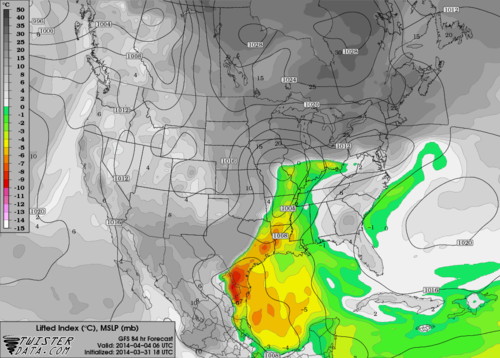 |
| GFS lifted indices valid 1am Friday |
Lastly this map shows the lifted index which is one indicator of atmospheric instability. Negative values indicate unstable air which is present in the Mid-South at this time. This means the atmosphere should not have any problems forming thunderstorms.
In summary, the threat of severe weather is still several days away and we cannot nail down exact details at this time. However, the potential for severe weather is definitely there with all types of severe weather possible. Although I talked specifically about ingredients necessary for tornadoes, we are still not sure until we get closer that this will be a primary threat. Hail and straight line winds will certainly be possible with storms Thursday and Thursday night.
-- William Churchill, MWN Social Media Intern
----
Follow MWN on
Facebook,
Twitter, and
Google+
Visit
MemphisWeather.net on the web or
m.memphisweather.net on your mobile phone.
Download our
iPhone or Android apps, featuring
StormWatch+ severe weather alerts!


No comments:
Post a Comment