Arrival of a cold front
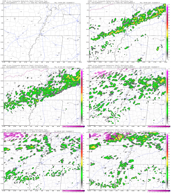
A general warm pattern looks to continue well into next week, but we do get a reprieve of closer-to-average conditions tomorrow, as a cold front moves across the metro this evening, lingers just to our south into Saturday, then makes a return trip back to our north as a warm front this weekend. If you're out and about this evening, you'll likely notice the front between 8-10pm as warm and humid conditions give way to showers and then a shift in the wind to the north, accompanied by a roughly 20-degree temperature drop. Here's forecast radar for this evening and overnight showing the rain: |
| Forecast radar for the evening and overnight hours from the HRRR model. If the GIF doesn't animate, click here. (WxBell) |
Friday into the weekend
With the front stalling just to our south, the much cooler surface air combined with a strong temperature inversion (warming air with increased height, rather than typical cooling) and abundant low-level moisture that produces a low cloud deck, will result in much cooler temperatures tomorrow. Look for morning bus-stop temperatures in the mid 40s and highs not much warmer, in the lower 50s. A cool northeast breeze will provide a stark contrast to today's tropical breezes and mid 70s highs!Next week
Looking at next week, a large scale system to our west, that is held at bay through the weekend by the Bermuda High pressure system over the southeast U.S., will start slowly moving east. A few showers are possible Monday, mainly afternoon and evening, as highs reach near 70° again. By Tuesday and probably into early Wednesday, periods of heavy rain and some thunderstorms are possible as the system, and it's upper level low, cross the region. Temperatures will remain mild, so there are no winter weather concerns, but not as warm as Sunday and Monday. We'll be watching rainfall amounts closely as some flooding is possible if heavy rain is prolonged. |
| The NWS predicts a solid 2" of rain for the metro over the next week with heavier amounts to our west where some impactful icing is also possible this weekend. (WPC/NOAA) |
Erik Proseus
MWN Meteorologist
----
Follow MWN on Facebook, Twitter, and Google+.
Visit MemphisWeather.net on the web or m.memphisweather.net on your mobile phone.
Download our iPhone or Android apps, featuring StormWatch+ severe weather alerts!
 | |
| MWN is a NOAA Weather Ready Nation Ambassador | Meteorologist Erik Proseus is an NWA Digital Seal Holder |


No comments:
Post a Comment