After a week of rain, cloudiness, and an occasional rumble of thunder, next week is looking sunnier already. However, here in the metro we need to get through one of more weekend of unsettled weather before that bright sunshine sticks around for at least a few days.
While the sun will peek out this afternoon, a round of upper level energy will set up additional showers and thunderstorms overnight tonight and into early Saturday. Most of this activity will remain south of the Memphis area, but a few storms could potentially reach the metro. Saturday will see a break in the storms by midday, before the severe weather threat increases late in the afternoon and into the evening hours. This threat could carry into the overnight hours, particularly south of the metro.
Showers and thunderstorms are expected to continue into Sunday, with the severe weather threat limited over the metro area. Occasional heavy downpours, small hail, and gusty winds cannot be ruled out in these storms, however. More than likely these thunderstorms will move across as the low passes overhead Memphis in the morning to early afternoon hours.
 |
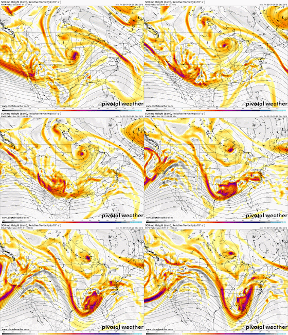
| An upper level low (oranges/reds rotating counter-clockwise and moving across the southern U.S.) sweeping west to east across our area, coupled with an unstable air mass, could bring severe weather to the Memphis area on Saturday and into early Sunday. Weather will improve into early next week, however, as the low moves east. (If image above does not animate, click here.) (PivotalWx) |
By the end of next week, we could see a return of more winter-like temperatures, with the mercury dropping overnight into the 30s and highs only in the 40s. You may have been asking where winter was, and it appears Mother Nature is ready to remind us!
Be prepared for this weekend’s severe weather by following us on social media for the latest information. Since the threat of severe weather could continue into the overnight hours on Saturday, having at least a couple ways to receive severe weather alerts is important. You can download the MemphisWeather.net app from your app store and add StormWatch+ for severe weather alerts for your hometown pushed to your phone or tablet. All pertinent links are listed below.
Alex Herbst, Meteorologist
MWN Social Media Intern
----
Follow MWN on Facebook, Twitter, and Google+
Visit MemphisWeather.net on the web or m.memphisweather.net on your mobile phone.
Download our iPhone or Android apps, featuring StormWatch+ severe weather alerts!
 | |
| MWN is a NOAA Weather Ready Nation Ambassador | Meteorologist Erik Proseus is an NWA Digital Seal Holder |


No comments:
Post a Comment