Rest of Today
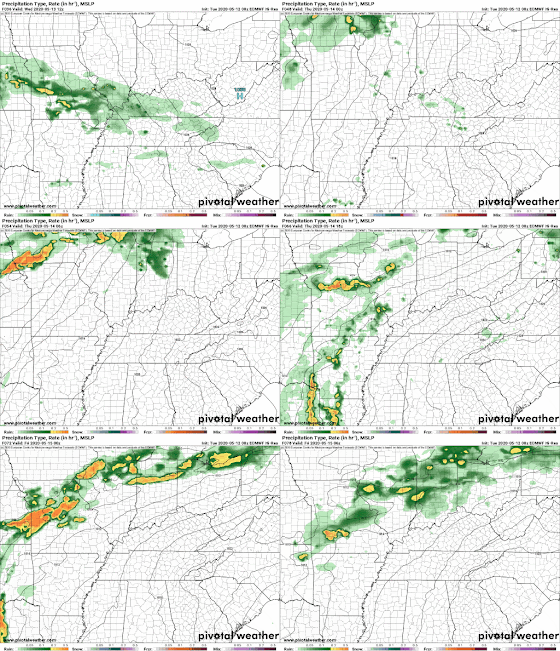
A weak high pressure remains over the southeast as light rain continues across areas along and north of the Mississippi/Tennessee state line this afternoon. Rain chances will decrease into late afternoon/early evening today but clouds hang on keeping our high temperatures near 60. Cool days will be behind us as a warm front moves up from the south tonight. This will shift our winds to the southeast and keep our temperatures fairly stable with overnight lows staying in the mid 50s. A few scattered showers are possible overnight and into early Wednesday as the warm front pushes north.
Wednesday and Thursday
Weak high pressure ridging will build over the southeast bringing drying conditions for Wednesday and Thursday. A few isolated showers early Wednesday are possible but much of the day will remain dry. Mostly cloudy conditions will give way to partly sunny skies by Wednesday afternoon with much more seasonable highs in the upper 70s. Overnight isolated showers are possible as southerly flow increases bringing moisture into the upper levels. Overall a nice night in store for Wednesday with mostly cloudy skies and lows in the mid 60s.
Thursday is much of the same with partly sunny skies and afternoon highs in the lower 80s - much more typical of mid-May! Winds will become more gusty throughout the day on Thursday out of the south between 10-15 mph with higher gusts. Continued warm air and moisture advection from the Gulf of Mexico will cause humidity levels to rise and allow for rain chances to increase heading into Thursday night. An isolated shower is possible before midnight but mainly to the west of the metro in eastern Arkansas.
Thursday is much of the same with partly sunny skies and afternoon highs in the lower 80s - much more typical of mid-May! Winds will become more gusty throughout the day on Thursday out of the south between 10-15 mph with higher gusts. Continued warm air and moisture advection from the Gulf of Mexico will cause humidity levels to rise and allow for rain chances to increase heading into Thursday night. An isolated shower is possible before midnight but mainly to the west of the metro in eastern Arkansas.
 | |
|
Friday and Saturday
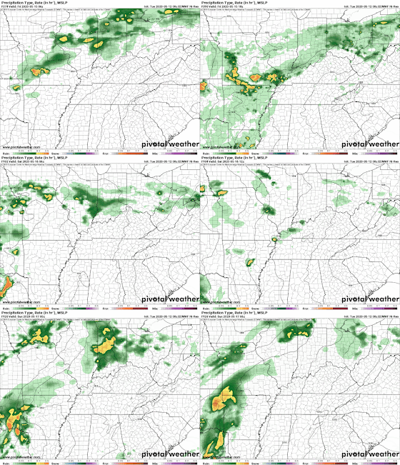
Isolated showers are possible Friday morning but scattered showers and thunderstorms will be present across the area by early afternoon. Everyone will likely see a shower on Friday but thankfully this will not be an all-day wash-out event. Afternoon highs will vary slightly depending on how much rain an area sees, but most of us will be in the lower 80s Friday afternoon. Overnight rain chances will slack off a bit but with a continued southerly wind, isolated showers and thunderstorms can not be ruled out. Into Saturday more of the same pattern will persist with a partly cloudy start to the day but scattered thunderstorms by the afternoon. Once again highs will be in the low to mid 80s across the region depending on how much sunshine are area gets.
Friday and Saturday bring us a much more seasonable pattern with warm and muggy afternoons. We have been lucky so far with humidity and temperatures levels staying fairly cool, but a persistent south wind will help to end that trend and welcome early summer weather!
Sunday through Tuesday
Keeping with the early summer pattern, Sunday will start off with temperatures in the upper 60s but bring another rain chance for the metro as a weak low pressure system approaches the southeast U.S. Conditions will be very similar to Saturday with partly cloudy skies transitioning into scattered thunderstorms and showers by the afternoon and highs warming into the lower 80s. The low pressure system will stall out in northern Louisiana late Sunday keeping rain chances around for early next week. Monday will be a mix of sun and clouds with scattered thunderstorms across the metro area for most of the day. Afternoon highs will be continue to be in the lower 80s and overnight lows will fall into the mid 60s. More of the same for Tuesday with partly sunny skies and scattered showers with highs in the mid 80s by the afternoon.
Allison Paige
MWN Meteorologist Intern----
Follow MWN on Facebook and Twitter for routine updates and the latest info!
Complete MWN Forecast: MemphisWeather.net on the mobile web or via the MWN mobile app
Download our iPhone or Android apps, featuring StormWatch+ severe weather alerts!
 |  |
| MWN is a NOAA Weather Ready Nation Ambassador | Meteorologist Erik Proseus is an NWA Digital Seal Holder |


No comments:
Post a Comment