Pages

Tuesday, August 25, 2020

Hurricane Laura strengthens; remnants to impact the Mid-South

Laura became a hurricane in the southeastern Gulf of Mexico this morning about 7am and has intensified only slightly since that time as it churns northwestward towards the central Gulf Coast. However, more rapid intensification is expected over the next 24 hours as it nears the coast, ultimately reaching major hurricane (category 3) status by the time it reaches the coast near the TX/LA border overnight Wednesday night. Here's a look at the visible satellite imagery of an organizing Laura the last couple of hours before sunset Tuesday:


The track provided by the National Hurricane Center at 4pm Tuesday (below) shows the turn from the west to north tonight and tomorrow and landfall around midnight Wednesday night with maximum sustained wind of 115 mph and gusts to 140 mph! It should be noted that there is still some discrepancy between the models, and it is entirely possible that it could be a bit stronger than that. In addition, the Hurricane Warning extends as far west as Galveston Bay (Houston) and the storm could still shift a bit more to the west towards the greater Houston metro. Needless to say, a strong category 3 storm sideswiping a massive American city like Houston during a pandemic could be devastating (2020, it that you?), but no matter where the center hits (Beaumont, Lake Charles, or vicinity), the results will be simply awful.


After landfall, Laura will take a path north along the TX/LA border into Arkansas by Thursday evening, still as a tropical storm. By Thursday night, Tropical Storm Laura is near Little Rock and starting to take a turn to the east as it gets caught up in strong westerly wind flow. The center of the remnants should be north of Jonesboro near the AR/MO line by Friday afternoon then swiftly move by to our north and across KY through mid-day Saturday.

As for Mid-South impacts, we will know it passed nearby. We'll see chances of showers and thunderstorms for the next couple of days leading up to its approach, but our best chance for impact-ful weather from Laura will be late Thursday through Friday night. This is when we could see wind gusts close to 40 mph (particularly daytime Friday) with sustained wind to 20-30 mph. In addition, periods of heavy rain are likely Friday into Friday night, though heavy downpours could be scattered about or in bands Thursday afternoon as well. In addition, tropical remnants are occasionally known to throw out (typically weak) tornadoes, and we'll be on the right side of the storm track for those to possibly occur, again most likely Friday when temperatures are warmest and instability highest.


The main threat though, besides some trash can throwing wind gusts, will be heavy rain. The Weather Prediction Center currently has much of AR right up to the Mississippi River in a Moderate Risk for excessive rainfall capable of producing flash flooding Thursday into Friday morning, though I expect a similar threat to be extended in to Friday. For now, west TN and northwest MS are in a Slight Risk, but that may be higher on Friday as the storm passes to our north. Current rainfall projections from the NWS are between 4-5" for the metro through Sunday evening. This does include additional showers and scattered thunderstorms this weekend after the storm passes as well.


My suggestions for preparation on Wednesday and Thursday:
  • Tie down or bring inside any loose outdoor objects, including patio seat cushions!
  • Make sure gutters and storm drains are clear of debris and ready to accept heavy rain.
  • Know where you'll go and have your safe place ready just in case a Tornado Warning is issued
  • If out in heavy rain, avoid swollen waterways (and watch your kids closely too) and don't drive into areas where water covers the road.
Scattered showers and thunderstorms unfortunately remain in the forecast for several days after Laura's remnants pass, so remember that after heavy rain has saturated the ground from Laura, additional rainfall is more likely to run off and result in flooding in low-lying areas more easily. There are early hints of a potential pattern shift as we hit the first of September. Let's get through this week first though!

Stay safe and follow us on social media for the latest information!

Erik Proseus
MWN Meteorologist

----
Follow MWN on Facebook and Twitter for routine updates and the latest info!
Complete MWN Forecast: MemphisWeather.net on the mobile web or via the MWN mobile app
Download our iPhone or Android apps, featuring StormWatch+ severe weather alerts!
MWN is a NOAA Weather Ready Nation Ambassador Meteorologist Erik Proseus is an NWA Digital Seal Holder

Saturday, August 22, 2020

It's still 2020! TWO hurricanes in the Gulf of Mexico this week?

Many of you are aware, perhaps from hype articles/videos shared by unscrupulous (or perhaps just naive) sources on social media, that the Gulf of Mexico will be visited by two tropical systems this week. Typically, I devote space on this blog to weather that has impacts to the Memphis area. 

Since it is appearing possible that we could get some tropical remnants later next week, which I will get into in a minute, I'm going to entertain the discussion/bust myths of merging tropical systems, the possibility of a mega-super-duper-storm, and the "new term" Fujiwhara effect. 

Forecast tracks of Marco and Laura

As of 4pm Saturday, the National Hurricane Center forecasts for Marco (currently passing between Cuba and the Yucatan peninsula of Mexico) and Laura (sliding west of Puerto Rico towards Hispaniola) are now presenting the very real possibility not only of two hurricanes in the Gulf at the same time, but a double-landfall within 48 hours of each other on the Gulf Coast, perhaps affecting the same area twice. 

If two storms of at least tropical storm strength are in the Gulf at the same time, which looks likely for a short time late on Monday, it will be only the third time on record. If two hurricanes are in the Gulf at the same time, also possible, it will be the first time on record. (Of course, it's #2020.) Here are the forecasts as of 4pm CDT Saturday:


There are still a lot of uncertainties on both systems, which I will not delve into here, but it's good to remember that these forecasts can be fairly uncertain multiple days out despite advances in forecast techniques. You'll notice though that Marco now appears to be headed for the central Gulf Coast with landfall projected Monday afternoon in southeast Louisiana as a hurricane (perhaps a very strong tropical storm). Just two days later, Wednesday afternoon, Laura heads for the same approximate area as a hurricane and likely stronger than Marco. Again, lots can change - and has just in the past 24 hours. However, a double-landfall in the same general area could be devastating for said area in terms of flooding, storm surge, and strong wind that could be dealt a powerful blow by a second storm after being weakened by the first. Let's hope and pray not.

Dualing tropical systems and the Fujiwhara Effect

As for the interaction of the two, it appears right now that this is fairly unlikely given that Laura is forecast to be just entering the southern Gulf as Marco makes landfall in the northern Gulf. But let's talk for a second about the Fujiwhara Effect - a term that is indeed NOT new (just like Polar Vortex and bombogenesis), but new to us because it doesn't happen often, and rarely in the Atlantic/Gulf of Mexico basin. It is more common, though still somewhat rare, in the western Pacific where there tend to be more tropical systems. 

The AMS Glossary of Meteorology defines it as "the tendency of two nearby tropical cyclones to rotate cyclonically about each other as a result of their circulations' mutual advection." Notice it does not say "merge into a megastorm and result in massive death and destruction." In fact, the forces acting on and around a tropical system that cause it to maintain itself would be destructive to another system that approaches it. I think the best way I have seen it described in a visual fashion is through the animation in this really cool tweet:


Mesmerizing isn't it? Go ahead, watch it again.

Notice that as these "tropical storms in a virtual lab" approach each other, they tend to either repel or weaken one another, with the weaker of the two typically falling apart, sometimes with the remnants being absorbed by the larger one. So, while it doesn't appear Laura and Marco will have much influence on each other this week, if they were, it would likely just be a minor deflection of one or the other system or a further weakening of the "weakest link," not a massive COVID-cane named "Laurco."

Effects on the Mid-South

Looking out a bit further, most models that agree with the NHC assessment of the forecast tracks right now bring the remnants of Laura into the Mid-South later next week. We'll definitely be watching this as it could mean a healthy dose of precipitation - perhaps a couple of inches - and some gusty wind. Further forecasts will refine that, but for now, the Weather Prediction Center of the NWS provides the precipitation forecast for the upcoming week below, which presumes some tropical moisture moving across the Mid-South about Thursday or Friday. It's got the Memphis area solidly in the 2"+ range.

The Weather Prediction Center forecast for rainfall over the coming week. The influence of two tropical systems on the Gulf coast is easy to pick out with remnants moving north through the lower Mississippi Valley late in the week. (WPC via Pivotal Weather)


Erik Proseus
MWN Meteorologist

----
Follow MWN on Facebook and Twitter for routine updates and the latest info!
Complete MWN Forecast: MemphisWeather.net on the mobile web or via the MWN mobile app
Download our iPhone or Android apps, featuring StormWatch+ severe weather alerts!
MWN is a NOAA Weather Ready Nation Ambassador Meteorologist Erik Proseus is an NWA Digital Seal Holder

Friday, August 14, 2020

A reprieve from the humidity and downpours is on the horizon

Over the last week we saw quite a few showers and storms across the area, some with very intense rainfall that produced multiple inches of rain in spots. Our temperatures over the last week have sat near normal, so that's good! Near average temperatures will continue for the next few days before potentially dropping to below normal! The 6-10 day outlooks for temperature and precipitation look promising. We could have both below normal temperatures and precipitation!

Nice Weather GIFs | Tenor 

This weekend

After we top out near 90, Friday night lows will drop to the mid 70s. Saturday we will top out near 90 under partly cloudy skies. A very isolated shower or storm is possible in the afternoon. Once the sun sets and we head into nighttime hours, clouds will clear early and temperatures will drop to the mid 70s. Heading into Sunday, there exists a slight chance of a shower in the morning as a front moves through. After possible isolated showers the temps will top out near 90 under partly cloudy skies. Sunday heading into Monday lows will drop to the upper 60s. "Upper 60s, you hear me?!?"


This upcoming week

The beginning of this week will feel much better then much of this summer. This is because a cold front is expected to come through, dropping both the temperatures and dewpoints (leading to overall lower humidity). 

Day 2 image not available
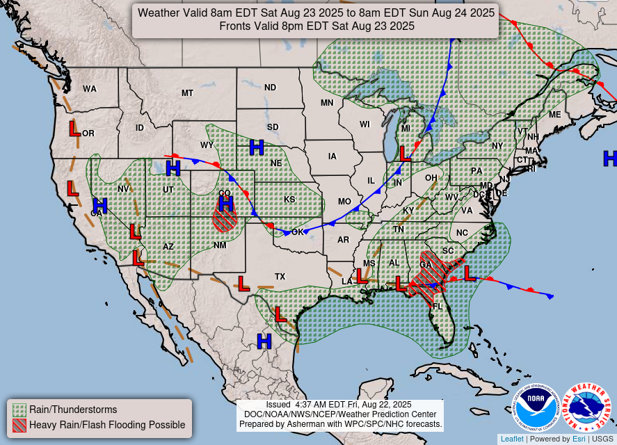
This is the Saturday evening surface map showing that the Weather Prediction Center (WPC) is expecting a cold front to pass through the Memphis area. A cold front is denoted by the blue triangles on the right side of the blue line. 

Monday during the day we will top out near 90, but it won't feel too terrible as the humidity should be rather low. Monday night and into Tuesday temperatures will again drop to the upper 60s. Tuesday's temperature will be very similar to Monday, so expect low humidity, and partly cloudy skies. Tuesday night and into Wednesday will be similar to previous nights as temperatures will drop to the upper 60s. Wednesday in the afternoon hours, we will peak in the upper 80s under partly cloudy skies. Heading into Thursday temperatures will drop to the upper 60s for the fourth night in a row! It may be a good idea to open the windows overnight to let in some of that cool air.

Thursday's temperature will top out in the upper 80s under partly cloudy skies. Thursday night lows will drop to near 70 under partly cloudy conditions. Friday afternoon temperatures will top out near 90, with a slight chance of showers, and partly sunny skies. 

Beyond One Week

The Climate Prediction Center (CPC) is predicting a rather nice few days near the end of next week and the beginning of the following. Between the dates of August 20th-24th the temperatures are expected to be below normal, and precipitation is expected to be below normal. This will hopefully mean that we will be in store for a pleasant, dry period next weekend as well! 

6 to 10 Day Outlook - Precipitation Probability
The CPC is predicting below normal precipitation for the Memphis area from August 20th to August 24th.  


6 to 10 Day Outlook - Temperature Probability
The CPC is expecting below normal temperatures for the Memphis area from August 20th to August 24th.   


Max Magness
MWN Meteorology Intern

----
Follow MWN on Facebook and Twitter for routine updates and the latest info!
Complete MWN Forecast: MemphisWeather.net on the mobile web or via the MWN mobile app
Download our iPhone or Android apps, featuring StormWatch+ severe weather alerts!
MWN is a NOAA Weather Ready Nation Ambassador Meteorologist Erik Proseus is an NWA Digital Seal Holder

Sunday, August 9, 2020

July 2020 Climate Data for Memphis, TN

July Climate Recap

A string of cooler than average months ended in July as temperatures crept back above normal. July's heat was not only above average, but very persistent. Every day during the month reached at least 89° and only two days failed to reach 90°, a feat only reached or eclipsed in three previous years (1954, 1993, 2010). In addition, there was little relief at night as the low temperature never dropped below 71°. This record has only been achieved in eight previous Julys. most recently 2016. Precipitation for the month totaled less than two inches despite some areas receiving much more rain due to the nature of scattered summertime thunderstorms.

Severe weather was very limited in July. As is typical, summertime thunderstorms occasionally produce limited reports of damaging wind gusts. Wind damage in the form of tree and power line damage was reported on July 1 in the Millington area and on the 16th in northern Crittenden County. Only a few Severe Thunderstorm and Flash Flood Warnings were issued over the course of the month.

Memphis International Airport, Memphis, TN


Temperature 
Average temperature: 84.1 degrees (1.4 degrees above average) 
Average high temperature: 93.0 degrees (1.4 degrees above average) 
Average low temperature: 75.3 degrees (1.5 degrees above average) 
Warmest temperature: 97 degrees (20th) 
Coolest temperature: 71 degrees (1st) 
Heating Degrees Days: 0
Cooling Degree Days: 603 (54 above average) 
Records set or tied: None 
Comments: July 2020 ended in the top 10% of hottest Julys on record in Memphis, ranking #18. The high temperature reached 90 degrees every day except two, and on those two the high was 89 degrees. Only five years in 146 years of record keeping had more 90-degree days in July.

Precipitation 
Monthly total: 1.73" (2.86" below average) 
Days with measurable precipitation: 14 (5.2 days above average) 
Wettest 24-hour period: 0.44" (28th) 
Snowfall: None 
Records set or tied: None 
Comments: None

Miscellaneous 
Peak wind: Northwest/47 mph (1st) 
Average wind: 6.2 mph 
Average relative humidity: 71% 
Average sky cover: 50% 

 Click here for a daily statistical recap for Memphis International Airport.
 

Cirrus Weather Solutions / MemphisWeather.net, Bartlett, TN


Temperature 
Average temperature: 81.9 degrees 
Average high temperature: 93.7  degrees 
Average low temperature: 73.1 degrees 
Warmest temperature: 99.2 degrees (20th) 
Coolest temperature: 68.2 degrees (13th) 
Comments: None 

Precipitation 
Monthly total: 2.18" (automated rain gauge), 2.07" (manual CoCoRaHS rain gauge) 
Days with measurable precipitation: 12 
Wettest date: 0.67" (1st) (via automated gauge) 
Snowfall: None 
Comments: None 

Miscellaneous 
Peak wind: Northwest/27 mph (1st)
Average relative humidity: 81% 
Average barometric pressure: 29.94 in. Hg
Comments: None

Click here for a daily statistical recap for Bartlett, TN.
 

MWN Forecast Accuracy


MWN average temperature error: 1.32 degrees 
MWN forecast temperatures within 2 degrees of actual: 87% 
MWN average dewpoint error: 1.60 degrees 
MWN forecast dewpoints within 2 degrees of actual: 81% 

MWN's forecasts extend out five periods (2.5 days, or roughly 60 hours). Historical accuracy statistics can be found here.
 

Climate Outlook - August 2020


The August climate outlook for the United States from the Climate Prediction Center is shown below. Above average temperatures are forecast for areas west of the Rocky Mountains and the east coast and New England. Cooler than average temperatures are forecast for portions of the central Plains into the Mid-South. Odds favor below average temperatures for Memphis (42%) versus only a 25% chance of above average temperatures. Memphis' average temperatures for August is 82.0 degrees.


Wetter than normal weather is expected in the northern Plains, as well as the eastern U.S, particularly the Mid-Atlantic coast. Drier than average weather is forecast for the desert southwest and Rocky Mountains into the Pacific Northwest. For Memphis, odds favor average rainfall, which historically averages only 2.88 inches in August. 

--- 
Follow MWN on Facebook and Twitter for routine updates and the latest info! 
Complete MWN Forecast: MemphisWeather.net on the mobile web or via the MWN mobile app 
Download our iPhone or Android apps, featuring StormWatch+ severe weather alerts!
MWN is a NOAA Weather Ready Nation Ambassador Meteorologist Erik Proseus is an NWA Digital Seal Holder

Saturday, August 1, 2020

Notes on July heat, plus a look ahead at pleasant August conditions!

Looking back

For those of you who thought July was hot - you're right! But July is climatologically the hottest month of the year (just barely edging out August). So what made July 2020 different? Was it just our continuing intolerance for more discouraging news, or is there something more to it? It may be a bit of both. Here are some facts.

While July 2020 was indeed hot (averaging about 1.5 degrees above a normal July), the main issue was the persistent heat. Check this out: Memphis hit 90° every day except two in July, and those two days it was 89°! How often does the high temperature reach at least 89° every day in July? Not often! There are only four years out of 146 in Memphis weather records in which every July day reached at least 89°. The last time was 2010. So the heat was persistent

How about the overnight lows? Well, as it turns out, we never dropped into the 60s in July overnight. In fact, all but one morning low was at or above 73° (and the one 71° low we had was on the 1st)! There have only been four years on record in which the low was at or above 73° every day or all but one day. So we also had very little relief from the heat at night.

Temperature anomaly (difference from average) for the U.S. in July. (WeatherBell)

With typical to slightly above average humidity during the month, heat indices eclipsed 100° almost every day as well and touched the danger level of 105° on several days. And while some lucky folks got several days of afternoon thunderstorms, many did not. The airport, and many other places, left the month with less than two inches of total rainfall and in "abnormally dry" condition. I'm OK putting July 2020 in the rearview mirror!

Looking ahead

If you were out last evening, you may have started to notice a change in the air. A pleasant breeze and slightly lower humidity made for a nice evening. This morning, clouds linger over the Mid-South with patchy light rain as low pressure spins over the region. In the wake of a cold front today, and with clouds lingering, we're set for our coolest day since June 26 with highs only near 80° and a pleasant breeze continuing! 

"Day cloud phase" satellite imagery from GOES-16 on Saturday morning shows a swirl of low clouds (in blues/greens) over the area, representative of low pressure. As long as low clouds stick around, temperatures remain in the 70s. (College of DuPage)

But is this one day of relief or a trend? Fortunately, the latter, though not quite to this extent. A large and persistent trough of low pressure will set up over the northeast U.S. but it's effects will cover a large portion of the eastern half of the country. With "northwest flow" set up over the Mid-South for the next week, we're in for less humid days, just spotty rainfall chances, and below average temperatures!

A trough of low pressure at the mid levels (~18,000 feet up) is indicated by the "valley" in the pressure lines over the Midwest and Mississippi Valley. The blue shading shows departure from normal for this time of year. Blue = cool! This map shows the average pressure pattern over the next 5 days from the European ensemble model. (WeatherBell)

This weekend will be a transition to that pattern with warmer weather, but still low humidity and some clouds, on Sunday as highs reach 87° following a morning low in the mid to upper 60s. A reinforcing cold front arrives Monday with a small chance of rain and similar temperatures to Sunday.  Another small rain chance moves in Tuesday with an upper level disturbance rotating around the parent trough. That will knock highs down a couple more degrees, perhaps only the lower 80s north of the city and mid 80s in Memphis and north MS. 

Similar to the map above, the 5-day average temperature anomalies from the European ensemble model shows well below average temperatures the next 5 days over the center of the country. For Memphis, the average temperature departure from normal is 5-6° F, enough to make for pleasant August days! (WeatherBell)

Partly cloudy conditions are expected the rest of the week with highs in the mid 80s, warming back towards 90 by the end of the week, but still pleasant humidity levels. I think you'll especially like the mid 60s every morning as you drink the first cup of coffee on the patio, as well as 70s in the late evenings for a nice walk!


Further into the future

Starting next weekend, it appears we return to a more average August setup with highs back in the low 90s, lows in the 70s, and rain chances re-emerging occasionally. Overall, though, it does not currently appear that the second week of August will see above average, or excessive, heat.

The temperature outlook from the Climate Prediction Center for the second week of August. Temperatures in the Mid-South should be near to slightly below normal. (via PivotalWx)

Erik Proseus
MWN Meteorologist

----
Follow MWN on Facebook and Twitter for routine updates and the latest info!
Complete MWN Forecast: MemphisWeather.net on the mobile web or via the MWN mobile app
Download our iPhone or Android apps, featuring StormWatch+ severe weather alerts!
MWN is a NOAA Weather Ready Nation Ambassador Meteorologist Erik Proseus is an NWA Digital Seal Holder