As the Memphis area goes on 10 days since our last precipitation, a full-blown blizzard / Nor'Easter / "Bomb Cyclone" (yes, that is a real term, not media-derived hype) is ravaging much of coastal New England from New York City to Maine. Snow covered the sand as far south as the beaches of South Carolina this morning, while wind gusts to 70 mph and 2-3" per hour snow rates are hitting the Atlantic beaches on Cape Cod. Eastern Massachusetts, Rhode Island, and coastal Maine will likely be measuring their snow totals with a yard stick when it's all done!
BOMBOGENESIS! The latest @NWSWPC and @NWSOPC surface map analyzed the rapidly strengthening low-pressure system at 975 mb, a 35 mb drop in the last 18 hours! Visible satellite imagery reveals a classic, "comma-shape" system, indicative of a maturing cyclone. pic.twitter.com/ry4a0iIhTm
— NWS Weather Prediction Center (@NWSWPC) January 29, 2022
Closer to home, a reinforcing shot of cool and dry air passed through yesterday with the upper level energy responsible for that also contributing to the rapid development of the low pressure system responsible for the misery on the east coast. We have seen dewpoints (a measure of absolute moisture in the air) drop into the single digits overnight which, combined with light wind and clear skies, meant a very cold morning with lows in the mid teens outside the city and around 20 in the urban core. So there's nowhere to go but up, right?
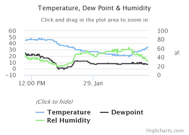 |
| A graph of temperature, dewpoint, and relative humidity over the past 24 hours at Memphis International Airport. Check out the dewpoint (black line) bottoming out near zero last evening! (NWS) |
This weekend into Monday
Sunny skies are expected throughout the weekend with surface high pressure in control and cool northwest flow aloft keeping high temperatures in the mid 40s today. However, the southerly breezy starts to work its warming magic and by Sunday we'll see highs in the upper range of the 50s, making for a very pleasant day. Overnight lows tonight stay just above freezing in the city.
More sunshine on Monday with morning lows again near or just above freezing, but south wind helping to push those high temperatures into the mid 60s! Another beautiful day to start the week, and if you're looking for a nice day to play hooky from work this week... this is it!
Mid-week moisture return
Much of Tuesday will continue to be dry, but our upper air pattern becomes southwesterly and with southerly surface wind as well, mild temperatures are expected but clouds increase and we'll start to see rain chances tick up by early evening - the first rain in nearly 2 weeks by that point. Temperatures start in the mid 40s in the morning and rise to the mid 60s once again.
Tuesday night through Wednesday will see likely periods of rainfall and continued mild temperatures - near 50 for the low and 60+ again for Wednesday's high. Thunder is not expected and rainfall should not be particularly heavy, but showery conditions will mean a chance of a few steady downpours. If the groundhog were in Memphis Wednesday morning, it likely would predict an early spring.
Wednesday night into Thursday - shenanigans?
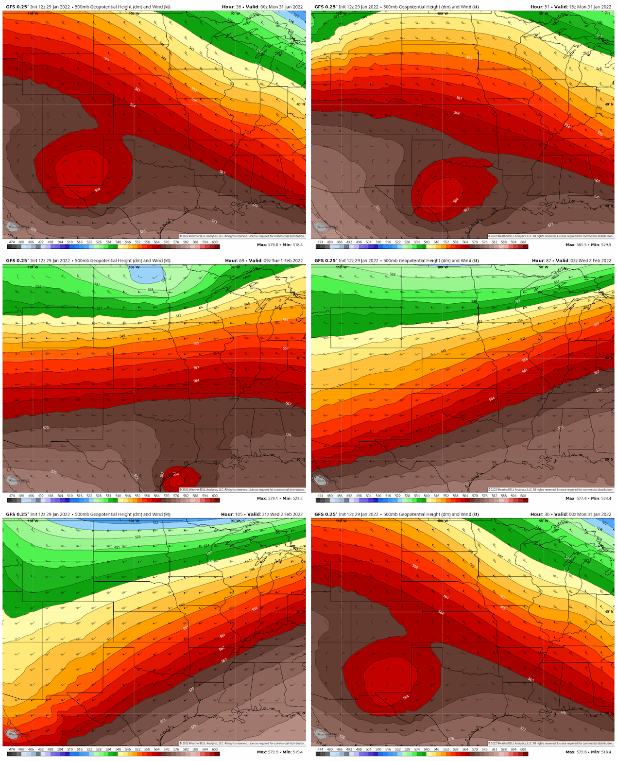
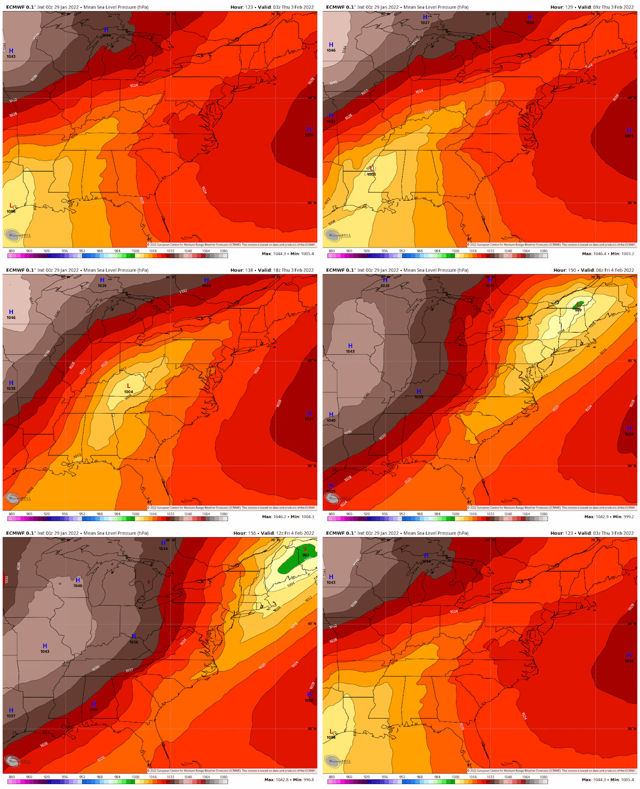
By Wednesday night, we'll be seeing another blast of cold air seeping south towards the region. In addition, low pressure will form Wednesday over south Texas and then move northeast, pushed by southwest flow aloft. Expect wet conditions Wednesday night, when the heaviest rainfall is most likely. By Thursday morning, precipitation totals since Tuesday evening could likely be approaching 2".
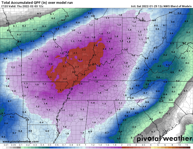 |
| The NWS Blend of Models shows precipitation amounts through Thursday morning between 1.5-2.0" for the Mid-South. |
Thursday is where my eyes are glued right now though. The key points will be:
- the track of the aforementioned low pressure center (which will pass by to our south across MS)
- the strength of that low, which affects...
- how quickly freezing air gets pulled south into our area behind the low, as well as...
- how long precipitation lingers.
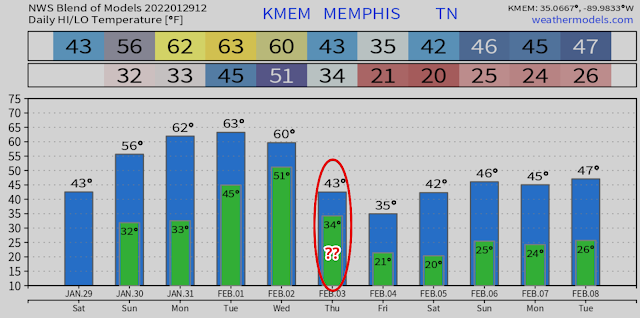
But does that mean snow? Not necessarily... With warm air aloft (thanks to those southwest winds), the cold air would likely be very shallow and near the surface. That means we could be looking at rain changing to freezing rain Thursday morning. This particular setup would mean 33° is just cold and wet, while 32° is an icy mess.
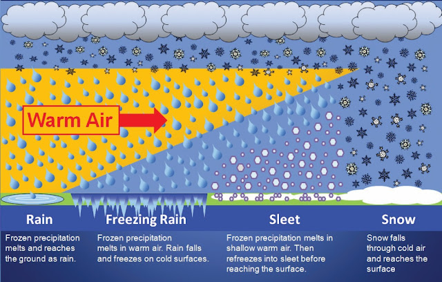 |
| The Memphis area MAY transition from scenario 1 above (rain) to scenario 2 (freezing rain) on Thursday morning. Still lots of details to emerge though! |
We're five days out, so right now the advice is "monitor the forecast and start giving through to preparations," as well as "stick with your trusted sources, not your computer mode driven weather apps." They will change on a whim, while your trusted sources will add reason to a complicated scenario. Stay tuned!
Friday into next weekend - more cold
Once the system exits sometime Thursday, another Arctic blast arrives leading into next weekend. Sunshine returns and temperatures bottom out in the teens to near 20 again Friday and Saturday mornings with highs in the 30s Friday and 40s Saturday. Beyond that, generally below average temperatures and precipitation area forecast into the week 2 portion of the forecast.
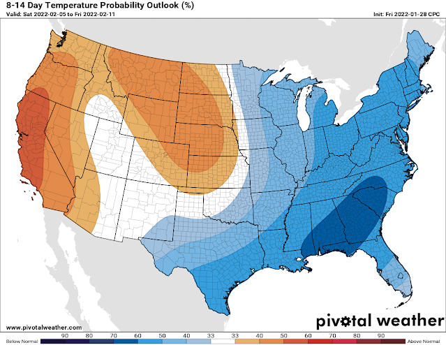 |
| The NOAA temperature outlook for week 2 (next Saturday through Friday the 11th) shows generally below average temperatures favored for the eastern half of the country. |
Erik Proseus
MWN Meteorologist----
Follow MWN on Facebook and Twitter for routine updates and the latest info!
Complete MWN Forecast: MemphisWeather.net on the mobile web or via the MWN mobile app
Download our iPhone or Android apps, featuring StormWatch+ severe weather alerts!
 |  |
| MWN is a NOAA Weather Ready Nation Ambassador | Meteorologist Erik Proseus is an NWA Digital Seal Holder |



No comments:
Post a Comment