A couple of weeks ago, it was an ice storm causing meteorological chaos across the metro. This past week we dealt with the spring version of inclement weather - strong to severe thunderstorms - though fortunately the tornado threat did not materialize in our area. A chilly post-frontal Friday has led into improving conditions this weekend, but more rain and storms are on tap for next week.
A pleasant weekend
An abundance of sunshine and wind becoming southerly by Sunday will help move the mercury in the thermometer the next couple days, as we reach 50 degrees today with that northerly breeze, but easily eclipse 60 tomorrow when it turns to the south. A great weekend for getting outside and doing some cleanup or prep for spring! It's not too far off! Those wind gusts on Sunday will be between 20-30 mph.
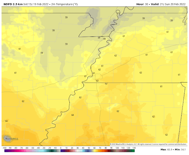 |
| Sunday mid-afternoon temperatures according to the National Weather Service. (NDFD via WeatherBell) |
Early week turns wet and stormy
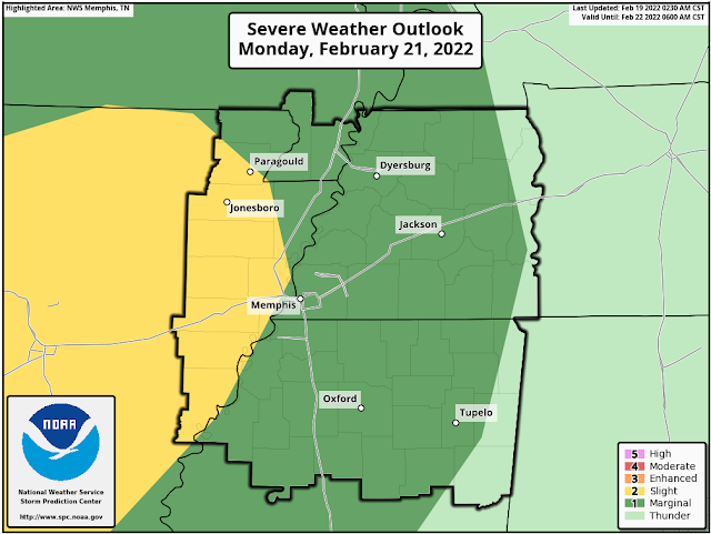
By Monday, the south wind will bring in increasing moisture and scattered showers are likely to break out to start the work week. The wind and moisture will make for mild conditions as well though, with a low near 50 degrees Monday morning and highs again in the mid 60s. A few thunderstorms could also erupt by afternoon. The Storm Prediction Center currently has areas west of the Mississippi River in a Level 2 Slight Risk of severe storms Monday afternoon/night while an accompanying Level 1 Marginal Risk is in place east of the river, including the Memphis metro. The main threats, again in AR, are scattered strong wind gusts and possibly some hail. Rain could be locally heavy as well, especially overnight.
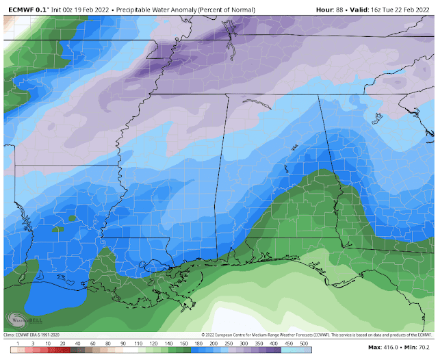
By Tuesday, a cold front approaches the area. With plenty of wind energy in place and some unstable air, the threat of severe weather shifts into the metro. In addition, atmospheric moisture content will be ultra-high. Coupled with a slow-moving front, heavy rainfall will be more widespread. So the main threats on Tuesday will be flooding of low lying areas and tributaries to the local river system, as well as scattered damaging wind gusts. With a good deal of wind throughout the lower atmosphere, the tornado threat cannot be ruled out, but is very low. Tuesday morning lows will be a balmy 60 degrees with highs near 70.
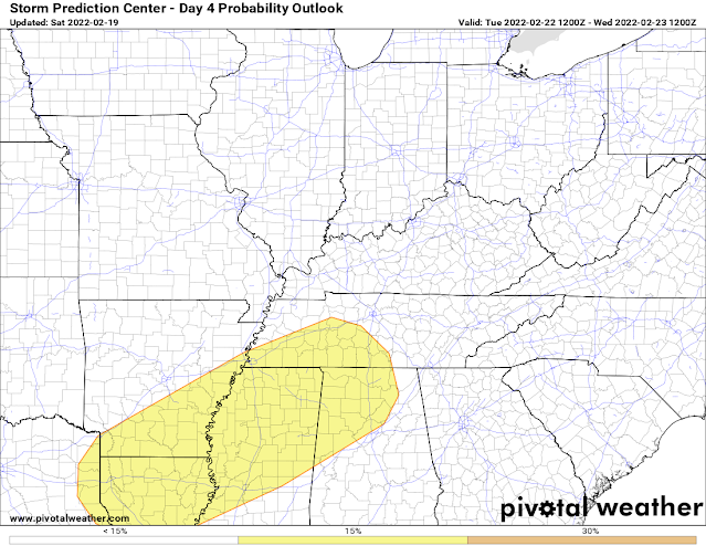 |
| The Storm Prediction Center has a level 2 risk of severe storms for most of the metro on Tuesday. Damaging wind is the main threat with a very small risk of a tornado. (SPC via Pivotal Weather) |
Storm system #2 arrives mid-week
The front moves through Tuesday night and we start to dry out for a minute. Temperatures cool down into the mid 30s by Wednesday morning and reach 50 degrees in the afternoon for the high. Unfortunately, southwesterly flow aloft means moisture continues to feed into the area and it appears by Wednesday evening at the latest, we're back in a wet pattern.
On Thursday, another front approaches the region, this one with additional wind energy and plenty of moisture in place. For now, the severe weather threat appears fairly low, but that could change, so you need to keep an eye on the forecast. In any event, rain could again be periodically heavy. By the end of the week, we could be looking at multiple inches of rain over a four-day window from Monday-Thursday. Rivers are likely to run higher and the threat of flooding will be higher Thursday with any heavy downpours due to saturated ground from Tuesday. Heading into next weekend, cooler and drier conditions look to prevail, not unlike this weekend. Hey, at least the weekends are decent!
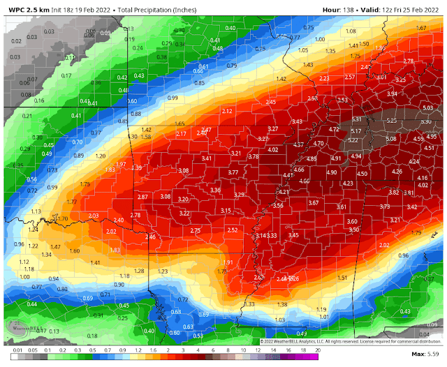 |
| The NWS Weather Prediction Center forecasts 4-5" of rain across the metro this week. Make sure the storm drains and gutters are clean! (WNOAA/WPC) |
This week is also Severe Weather Awareness Week in Tennessee. Look for tips and safety information from us and the National Weather Service all week long on social media. You can also visit the SWAW website for the state of Tennessee by clicking here to learn more about the daily topics that will be covered, online spotter classes, and more! We're closing in quickly on our peak severe weather season, as evidenced by the wild weather swings of the past few weeks and increasing temperatures between them, which will only add more storm fuel to the equation as we get deeper into March and April.
Erik Proseus
MWN Meteorologist
----
Follow MWN on Facebook and Twitter for routine updates and the latest info!
Complete MWN Forecast: MemphisWeather.net on the mobile web or via the MWN mobile app
Download our iPhone or Android apps, featuring StormWatch+ severe weather alerts!
 |  |
| MWN is a NOAA Weather Ready Nation Ambassador | Meteorologist Erik Proseus is an NWA Digital Seal Holder |


No comments:
Post a Comment