The overall weather pattern has become more favorable for drought and heat relief over the past couple of weeks, with improvements in both categories following a brutal June, July, and early August. So far this month, the average temperature has been over four degrees cooler than July, and yet we're still slightly above the typical August average. (That says more about July than it does August.)
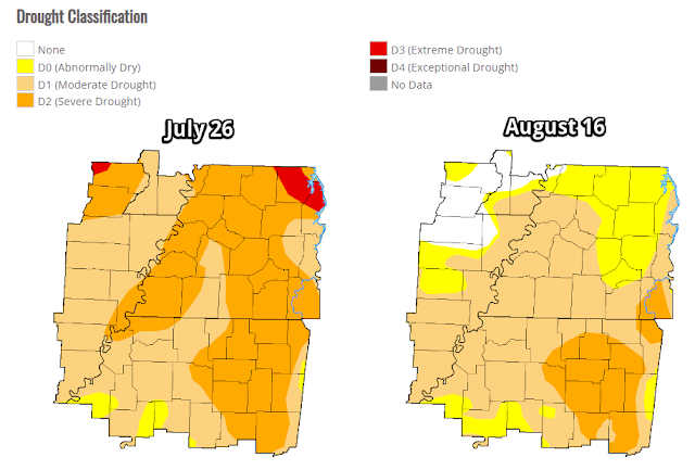
Rainfall the past few weeks has also put a dent in the drought. Below are the drought index maps from late July and this week. We still have a ways to go, particularly getting wet conditions deeper into the soil, but it's improving and what we see above ground is in much better shape than it was a few weeks ago!
Saturday-Monday: a weather "squeeze play"
A couple of frontal systems will play into how the weather evolves over the next 48-72 hours, which probably isn't ideal if you are looking for a completely dry and sunny weekend! Although we're not expecting any washouts, rain chances will be elevated, especially on Sunday.
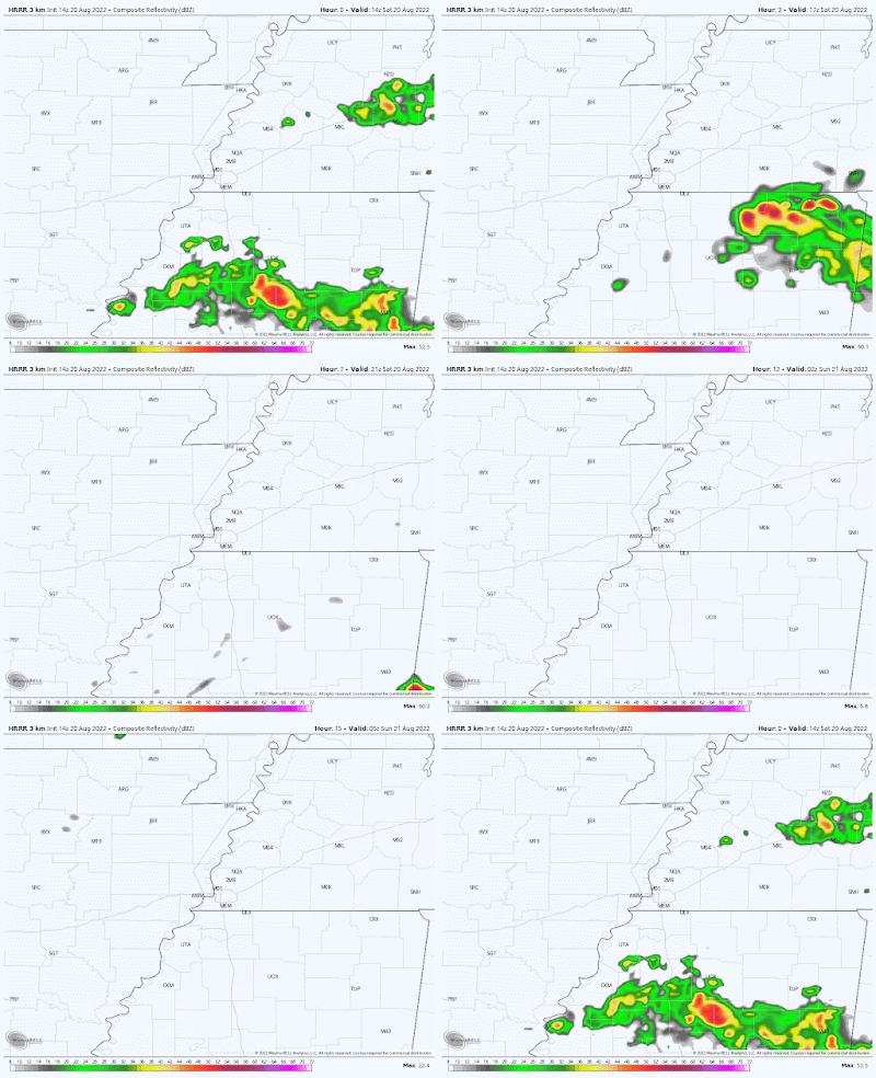
A warm front to our south on Saturday morning is lifting north, bringing scattered showers and thunderstorms to north MS this morning, spreading northeast. Additional pop-up showers and storms are possible across the metro this afternoon. While models aren't indicating a great deal of rain, we could see a little "whack-a-mole" on the radar throughout the day. In general, clouds will increase and dewpoints will slowly tick up into the low 70s on a southwest breeze as well. Look for highs near or just above 90 degrees. Overall coverage of cells will diminish to isolated overnight, so if you have tickets for Live at the Garden or other activities outdoors this evening, it's not likely to be wet.
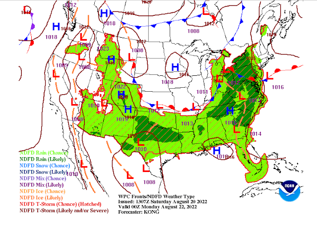
Meanwhile, to our north, a cold front is also inching south from the Ohio River Valley and Missouri. It will approach on Sunday as the warm front lingers over the area. This combination will provide our best chances of rain maybe for the coming week. Once again, it won't be a washout, but chances are probably higher than 50/50 that you will get at least some rain tomorrow, and thunderstorms are also possible, especially in the afternoon. Wea re not outlooked for severe weather, so the chances of strong wind and hail are minimal, but the lightning threat will need to be monitored if you plan to be outdoors. We'll probably have a "Pool Alert" at some point! Southwest wind will continue to feed the moisture into the area, so highs near 87 could be a bit uncomfortable in the muggy air. Rainfall should generally be a half inch or under for most, though some heavier cells could drop up to an inch. Rain chances wind down some, though not zeroed out, Sunday night with the cold front dropping over the metro.
By Monday, the cold front/warm front mash-up will be along the I-40 corridor and slowly continuing to ooze south. We'll see wind shift to the west with mostly cloudy skies. Rain chances continue, but at a bit lower level (30% or so), and the best chance will be in the afternoon over north MS ahead of said frontal boundary. Highs will remain in the mid 80s and there will still be some sticky air, but high dewpoints should start to retreat a bit as the front eases southward.
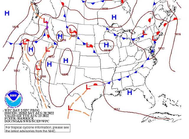 |
| The cold front, by Tuesday morning, will be well to our south, ensuring drier conditions and less humid air heading into the mid-week period. (NWS/WPC) |
Rest of the week: fairly average for August
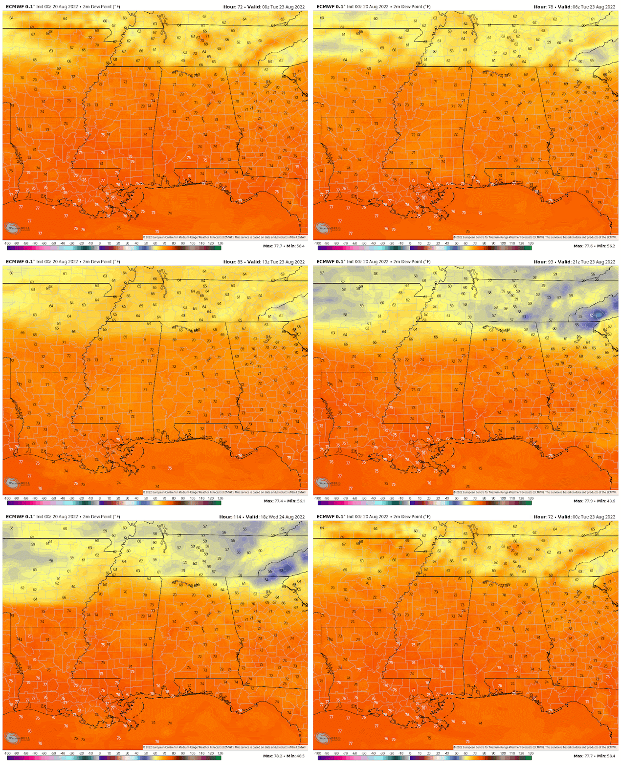
With the front pushing into north MS, rain chances should diminish even further for the mid-week time period. We're looking at partly cloudy skies, not-intolerable humidity levels, and high temperatures near 90 degrees, which is average for this time of year. With dewpoints suppressed a bit, there will be no big heat index issues and morning lows will probably drop into the upper 60s outside the city while remaining near 70 in the urban jungle.
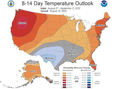
There are hints from some mid-range model data that we could get a return of the front to our south by late in the week, which might bring a few heat-of-the-day thunderstorms on Thursday and Friday. Other solutions indicate that it will stay dry with high pressure strengthening aloft. It does appear that temperatures could tick up just a bit towards next weekend, so lower 90s during the day and lower 70s in the early mornings seems to be where temps will fall.
To recap: scattered rain chances the next couple days, highest on Sunday, with slightly below average temperatures Sunday and Monday. Then mainly dry for much of the week ahead with temperatures returning to near average. It appears that August will indeed go down as a "cooler" month than July was. And for that, our utility budgets are appreciative!
Erik Proseus
MWN Meteorologist
----
Follow MWN on Facebook and Twitter for routine updates and the latest info!
Complete MWN Forecast: MemphisWeather.net on the mobile web or via the MWN mobile app
Download our iPhone or Android apps, featuring StormWatch+ severe weather alerts!
 |  |
| MWN is a NOAA Weather Ready Nation Ambassador | Meteorologist Erik Proseus is an NWA Digital Seal Holder |

No comments:
Post a Comment